Last Wednesday I had an interesting flight and ended up landing out at the base of the Kaimais, slightly south of the radar dome.
This was the second time I've been low around the golf ball without much wind this year. It can be a little daunting, as the ground slopes up to meet you, 1500' feels very low, and the terrain is rather undulating. Flying on the ridge is often done at lower than normal level, and if the wind stops, very quick thinking is needed. It's can be very hard to identify at what point to give up.
This particular day was forecast to be strong, but although working, was only around 10-15 knots. I joined the ridge at around 1800' and found it to be working well. I headed south to the radar dome, but on arrival was forced to track north again due to a shower going through.
I tracked up to TeAroha, then there was a shower arriving there as well, so I headed south again. The shower to the south had cleared so I ran all the way to the radar dome, around 2500'. Bill and I then climbed a bit, and spent some time spotting airstrips around this area, in particular an airstrip up the hill a bit. This would prove to be very useful later...
We then went back up to the waterfall again maintaing 2500' or so. At the waterfall we met up with VM, although I couldn't read his rego so dived down to see who it was. After doing this I thought, why not do a fun lower level run along the ridge, while waiting for the rain to clear to the north.
We all know where this is going. My thinking was:
- We had just been along there at 2500' and maintained height happily
- The rain had cleared through ages ago!
- VM was down lower, so it must be good! (never trust a glider with an engine...)
We all know that a shower going through can kill the wind on the ridge. What I learned that day is just how long it can take for the lower level wind to get going again. Ralph explained later that the rain and the cool air dumps onto the ridge and that coldness subdues the wind. At higher altitude it was working better which is why we were able to maintain altitude.
So basically I flew from the waterfall to the radar dome, and simply glided down the whole way. It didn't take long to realise the ridge wasn't working properly so dumped my water and thought 'no problem', once we get to the radar dome it'll be better, it always works better down there!
After doing a few figure of eights it quickly became apparent nothing was going up at all, so I found the airstrip we identified earlier and put it down.
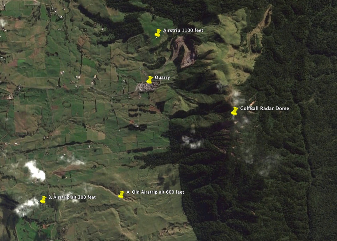
The airstrip (A) slopes upwards towards the hill so you have to land downwind on a ridge day. I've never landed on a steep slope before, but it worked out fine with the top third of the strip a little flatter than the rest. The glider didn't roll backwards down the hill, so it obviously wasn't too bad.
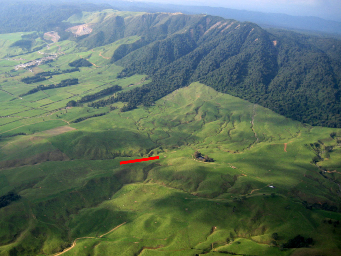
I found out this airstrip is now disused, however it was still in good enough condition to land on, except for an animal track running down the middle. The airfield is hard to spot due to the shape of the paddock, however the fertiliser bin at the top of it gives it away. It's also very close to a duckpond so that makes it easy to find once you know.
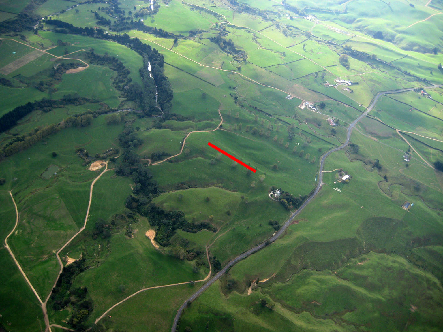
Walking down the hill through about 6 paddocks, I ended up at an occupied house and Old TeAroha Rd. Looking at my GPS maps while waiting for retrieve I discovered there was another airstrip (B) right beside where I was sitting! This one is longer and flatter, but with some big trees running down one side. It's also a lot closer to the road and a few hundred feet lower.
Thanks Bill for the photos from above, and a really big thanks to Bill, Keith and new student Peter for coming to retrieve me.
Tim